Posts Tagged: watershed
Headwaters
I have the privilege of engaging California's communities with the aspiration of safeguarding the sustenance and well-being that its oak-woodland watersheds and the people that are a part of them provide. This millennia-long integrated relationship of humans and land has parallel histories in other Mediterranean parts of the world. The following blog is the first of occasional installments about working Mediterranean landscapes in California and around the globe. Combined they will explore the concepts of watershed functions, working landscapes and Mediterranean climate, vegetation and management. Join me in experiencing these settings, growing our appreciation for the integrated nature of these landscapes and people, and gaining understanding and tools for our tenure as stewards. - David Lewis, director, UC Cooperative Extension, Marin County
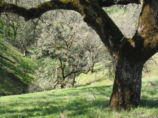
I am standing where stream flow begins, in a nameless tributary of the Russian River to the east of Hopland, Calif. This particular spot and location has been a grazing livestock ranch, primarily sheep, going back more than 100 years (learn more). This is one of thousands of spots in a watershed where water comes to the surface, joins in a channel and starts its path downstream. Many of us have stood at a confluence of two rivers or an estuary where a watershed's outfall meets an ocean. These locations are the stream's or river's end, their terminus. Where I am standing, is the headwaters of a stream system, where water is initially released and visible as a thin, shallow bouncing band.
Watersheds collect, store, and transport water. The transport function is performed by streams and rivers. These are dynamic, pervious channel networks each with a beginning and an end. At any part of the network, the channel is that lowest point in the landscape, stretching from one stream bank to the other, and generally widening in the downstream direction, until the stream mouth empties into another water body.
At the other end of a network is the channel head, where the channel begins. This is where I am standing. Channel heads are found in small, intimate folds in the landscape. These depressions are referred to by many names — draws, bowls, hollows — the place in hills where the slopes become shallow and coalesce.
Like an amphitheater, the surrounding hillslopes rise around me. Reaching out at shoulder height, I can almost touch these slopes. The mixed oak woodland and interspersed grasslands are in attendance across these slopes. Ghost pines, live oaks, black oaks and madrones, among other trees, make their stand interspersed with annual and perennial grasses blanketing the ground. This mosaic of vegetation is hosted and sustained by the complex mix of marine sediments that have been pushed up, forming these hills, and erosion carving the stream channel. Below the surface are soils one to three feet deep that have developed from the underlying geology.
It's March 3, 2019, and on the cusp of spring. Between the light breezes, the stream water sings its way downstream. I think back to the intense storms that moved across this part of California the week before and the resulting floods in the lower portion of the Russian River. Those and earlier winter storms soaked into the soil until the soil reached its capacity to hold water. Once the soils were primed, water was released to the channel network. That water is still being released now, days later, and will be for several more months into May or even June. Rainfall for this area and most of California has been substantial, matching amounts not seen since 1983, and definitively ending the nearly five-year drought. This contrast in extremes is the norm for California, meaning the next drought or next flood is only a year away.
Downstream the Russian River is perennial, flowing year-round. But here at the channel head, flow is intermittent on an annual cycle. Rains begin in the fall, with headwater surface flows starting in late fall or early winter, once soils are saturated. This wetting up process reverses in the spring, until the channel head is dry.
At some point this year flow in the headwaters will stop. Saturated soils releasing water laterally below the ground surface, will gradually release less and less water to the channel. Trees and grasses will demand more and more water as they leaf out and grow. As soils pores empty of free water, the remaining moisture is held more tightly to soil particles and plant root surfaces through a physical tension. Eventually the channel head will run dry.
While you may not have the opportunity to visit a channel head and experience the place where stream flow starts and stops each year, you are often closer to one than you think. Driving a rural road or hiking in a favorite park or open space will invariably find you crossing one of these unnamed headwater streams. As you do, give a look upstream, from where the water going past you has come. Up the channel into the bowl is one of the channel heads and headwaters for the watershed you are in.
I don't know when I will get to this channel head again. However, this place where surface flow is initiated will be close in my mind, particularly, as I visit the confluences and estuary of the Russian River, during the wet and dry periods and high and low rainfall years to come.
To learn more about these specific watersheds and research conducted in them this article is suggested. If interested in learning how stream flow is generated in California oak woodland watersheds you may want to read this article.
International and California water conferences shine new light on lingering drought
The gauge reads 105 degrees in California's state capital as this article is being drafted. The four-year drought has baked itself into the landscape, with dead lawns crunching under feet and trees wilting under the heat, and has so far stolen a year's worth of precipitation. Deprived of moisture, the state has lost to wildfires three times the acreage of an average year. The once green valleys are now murky fishbowls of haze.
The total cost to the state, according to a new report released Tuesday by the Center for Watershed Sciences (CWS) at the University of California, Davis, is now $2.74 billion and 21,000 jobs.
Some see this as the new normal and new evidence ties it to climate change.
But despite the profound impact on the California agricultural economy, the state is actually doing well. And it's becoming the world's test kitchen for best practices in adapting agriculture to changing water supplies.
A legacy of progressive environmental regulations
“Despite the drought, we have a remarkably robust agricultural system,” says Jay Lund, director of CWS. “If you go back millennia and look at droughts, with a 30 percent loss of water you'd have a 30 percent loss of food production and you'd have 30 percent of the people starving.”
That hasn't happened today, he says, because California agriculture is more diversified than ever and its economy is connected to a world food market that advances despite the drought.
The many tools that UC Agriculture and Natural Resources (UC ANR) and others are deploying to help Californians better adapt today are also being translated into immediate lessons for the developing world.
Stockholm comes to Davis
Starting Sunday, representatives from more than 200 organizations will meet in Stockholm, Sweden, for the World Water Week mega conference. Under the theme Water for Development, they will refine the United Nations' broad Sustainable Development Goals to address the one billion people who would still be without safe drinking water and basic sanitation.
Many partners of UC ANR and the UC Davis World Food Center will be leading some of the numerous discussions, including: CGIAR, the World Bank, the Bill & Melinda Gates Foundation and the UN Food and Agriculture Organization.
A separate conference at UC Davis in October will then bring the focus to California and water for food. This global event, called Water Policy for Food Security, will draw on lessons from World Water Week through shared speakers like Chris Brown, the general manager of responsibility and sustainability at Olam International, and Claudia Ringler, a senior researcher at the International Food Policy Research Institute, which is co-hosting the event.
Presentations on the Case of California will open two days of panel discussions, ranging from how climate change will impact the cost of water in different regions of the world to how groundwater aquifers can be recharged and how new policies can bolster water markets.
The goal is to seize the momentum now building for an international effort towards #WaterSecurity. By drawing development investors, leading scientists, committed policy makers and global industry partners into one room within the world's number one ag school, the event will set a course of action in sustainably securing water for food and for people across the planet.
College students create wildlife habitats in a Wild Campus program
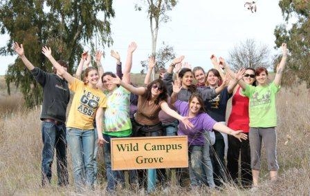
Put together a group of hard-working, do-good college students who care about environmental issues, and you end up with a really “Wild Campus.” At UC Davis, students formed the student-run Wild Campus organization two years ago to conserve wildlife in the greater UC Davis area.
Working with campus experts (such as faculty and staff in the Department of Wildlife, Fish and Conservation Biology) and local environmental and conservation organizations, the volunteer students are improving the habitats for local wildlife and engaging the public in hands-on activities.
This is an extraordinary program that gives the students real-world environmental management skills, along with leadership opportunities and communications experience. Professor John Eadie, Department of Wildlife, Fish and Conservation Biology at UC Davis, said of the Wild Campus program, “Hands-on activity is a huge part of the educational experience.”
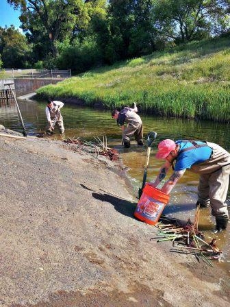
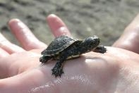
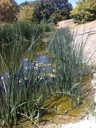
In the UC Davis Putah Creek Riparian Reserve, the students are establishing wildlife habitat areas and monitoring populations of amphibians, birds, fish, insects, mammals, and reptiles. They will record the changes over the course of time. Recent work in the riparian reserve (aka “the living classroom”) has included planting native oak seedlings, and installing tule plants to provide protection for the Western Pond Turtle, a species of concern.
A past project — Build a Wild Home Day — involved working with the UC Davis Arboretum on a successful public outreach program to build bird and bat boxes for installation on campus. (Great photos of this program are on the group’s Facebook page.)
The Wild Campus organization has a large cadre of eager and dedicated students who are improvising and making the most of limited resources. However, they are in need of donated field equipment (used equipment is fine) and financial contributions.
Visit the Wild Campus website and Facebook page for a feel-good look at what these ambitious students are doing to improve the environment, along with ways you can help them succeed.
Frolicking fat floodplain fish feed furiously
A very wet spring brought a good deal of water to the floodplains this year—good news for juvenile salmon that thrive in this habitat. Floodplains — such as the Yolo and Sutter Bypass areas and the Cosumnes River floodplains — provide a link for juvenile salmon between the gravel bedded rivers where they hatched and the ocean where they will spend the next one to five years.
Although salmon may only use the floodplain for a month or two, this could mean the difference between success and failure in their long journey to the ocean and back again. When juvenile salmon spend time on the floodplain, they grow faster than those that use only the river channel during their migration to the ocean (Sommer et al. 2001, Jeffres et al. 2006). Because of the increased growth, the juveniles are larger when they head out to sea; they can survive better by swimming faster and being more able to avoid predators.
What makes a floodplain a good place for rearing salmon? First of all, it needs to be connected to the river. This sounds obvious, but most of the floodplain habitat in California is isolated behind levees and only gets flooded during extreme high water events when the levees are overtopped or breached. The reason that the levees are there is to protect housing and agricultural land (orchards, vineyards, etc.), which doesn’t allow for regular inundation of floodwaters.
Why are these multi-purpose floodplains better than the river channel for rearing salmon? As cold floodwater enters a floodplain from the river, it spreads out, slows down and deposits sediment. Throughout this process, the water also warms slightly. This is essentially the priming of the productivity pump that will ultimately feed the juvenile salmon for the next couple of months. As the water slows, clears and warms, phytoplankton and algae begin to grow. Populations of animals that feed on the fast-growing plant life, such as zooplankton and other aquatic invertebrates boom. These animals comprise the main food of juvenile salmon on the floodplains.
Because salmon are cold blooded, water temperature it is an important component to floodplain suitability. If water is too cold, juvenile salmon are lethargic and growth is slow. If the water is too warm it causes increased metabolic demands and reduced dissolved oxygen, inhibiting growth and increasing mortality. Fortunately for California salmonids, out-migration is in the spring when temperatures are generally moderate. The timing of spring high flows onto floodplains allows for ideal temperatures for juvenile salmonids compared to the relatively cold water in the main river channel. When temperatures are good and food is abundant, juvenile salmon can grow at impressively fast rates, especially when compared to fish using the main river channel.
The combination of complex physical processes and ecological function is what separates the floodplain from the river corridor in the eyes of juvenile salmon. Leveed river channels provide little complexity and less than ideal growing conditions during the annual spring out-migration. When juvenile salmon have access to complex floodplain habitats where temperatures are good and food resources are abundant, they will grow to larger sizes and thus be able to survive better than fish that remained in the main river channel.
So, next time you catch a big healthy salmon, thank your local floodplain.
Further Reading:
Jeffres, C., J. Opperman and P. Moyle (2008), “Ephemeral floodplain habitats provide best growth conditions for juvenile Chinook salmon in a California river,” Environmental Biology of Fishes 83 (4): 449-458.
Sommer, T., B. Harrell, M. Nobriga, R. Brown, P. Moyle, W. Kimmerer and L. Schemel (2001), “California’s Yolo Bypass: Evidence that flood control can be compatible with fisheries, wetlands, wildlife and agriculture,” Fisheries 26 (8): 6-16.
New life for the delta ecosystem
The San Joaquin/Sacramento Delta and Suisun Marsh were once part of a continuous, enormously productive aquatic ecosystem that supported dense populations of fish from Sacramento perch to salmon, huge flocks of wintering waterfowl, and concentrations of mammals from beaver to tule elk. This amazing ecosystem is gone and cannot be brought back.
The once vast marshes have been turned into farmland and cities, protected by a complex system of levees. The patchy remnants of the original ecosystem are disappearing fast, as more and more native plants and animals become extinct or endangered. In their place, hundreds of alien species thrive in the altered conditions—crabs, clams, worms and fish from all over the world.
- We have a choice. We can let the ecosystem continue to slide towards being a mess of alien species that live in unsavory water flowing through unnatural pathways, or we can take charge and create a new ecosystem that contains the elements we want. Those elements include native species and clean water that flows in more natural patterns, creating a better environment for fish and people.
The State Water Resources Control Board recently supported this concept by recommending that much more fresh water flow through the estuary to the ocean to create a sustainable estuarine ecosystem. More water is only part of the recovery picture, however, because the flows must be managed in new ways and flow through restored habitats. The historical ecosystem can be used only as a model for the new system, mainly to identify conditions that favor remnant native species and have other desirable features. But the new ecosystem will be quite different in its locations, its biota, and how it works.
High variability in environmental conditions in both space and time once made the upper San Francisco Estuary highly productive for native biota, so variability is clearly a key concept for our new ecosystem (Moyle, et al. 2010). Achieving a variable, more complex estuary requires policies that create the following conditions:
- Internal Delta flows that create a tidally-mixed, upstream-downstream gradient in water quality, with minimal cross-Delta flows. At times much of the water in the present Delta flows towards the big export pumps in the South Delta. Fish trying to migrate upstream or downstream find this very confusing, often lethally so.
- Slough networks with more natural channel geometry and less diked, rip-rapped channel habitat.
- More tidal marsh habitat, including shallow (1-2 m) sub-tidal areas, in both fresh and brackish zones of the estuary.
- Large expanses of low salinity (1-4 ppt) open water habitat in the Delta.
- A hydrodynamic regime where salinities in the upper estuary range from near-fresh to 8-10 ppt periodically to discourage alien species and favor desirable species.
- Species-specific actions that reduce abundance of non-native species and increase abundance of desirable species, such as active removal of undesirable clams and vegetation.
- Abundant annual floodplain habitat, with additional large areas that flood in less frequent wet years.
- Treating the estuary as one inter-connected ecosystem, recognizing that changes in one part of the system will likely effect the other parts.
These habitat actions collectively provide a realistic, if experimental, approach to improving the ability of the estuary to benefit desirable species. Some of these goals are likely to be achieved without deliberate action as the result of sea level rise, climate change, and failure of unsustainable levees in some parts of the Delta. But in the near term, habitat, flow restoration and export reduction projects can allow creation of a more variable and more productive ecosystem than now exists, while accommodating irreversible changes to the system.
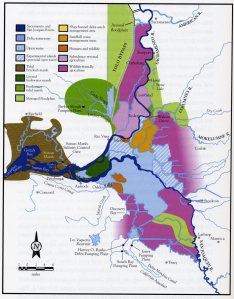 What a multi-purpose, eco-friendly delta could look like. Click on the image to view an interactive form of the map that lets you see descriptions of what each area might look like in a future eco-friendly delta.
(This post first appeared on the CaliforniaWaterBlog.)
Update: The National Research Council has taken an interest in plans to conserve habitat for endangered and threatened species in the Sacramento-San Joaquin Delta while continuing to divert water for agricultural and urban use in Southern California. On May 5, the council declared the draft Bay Delta Conservation Plan incomplete, difficult to understand and still needing much work.
Further Reading:
Moyle, P.B., J.R. Lund, W. Bennett and W. Fleenor (2010), Habitat Variability and Complexity in the Upper San Francisco Estuary, San Francisco Estuary and Watershed Science 8(3).
Cunningham, L. (2010), A State of Change: Forgotten Landscapes of California, Heyday Books, Berkeley.


