

Posts Tagged: water resources
Leaks an untapped opportunity for water savings

Reducing leaks a cost-effective way to save urban water without draining utilities
Before a drop of treated water in California ever reaches a consumer's faucet, about 8% of it has already been wasted due to leaks in the delivery system. Nationally, the waste is even higher, at 17%. This represents an untapped opportunity for water savings, according to a study from the University of California, Davis.
The study, published in the journal Environmental Research Letters, is the first large-scale assessment of utility-level water loss in the United States. It found that leak reduction by utilities can be the most cost-effective tool in an urban water manager's toolkit, provided utility-specific approaches are used.
“When I first heard about ‘leaks' I thought it sounded boring, but leaks are a huge component of our water systems and have a larger opportunity than many other water-saving methods to make an impact,” said lead author Amanda Rupiper, a postdoctoral scholar with the UC Davis Center for Water-Energy Efficiency. “As the first state to regulate its water losses, a lot of eyes are watching California, and this is an opportunity to impact policy here and elsewhere.”

Amid a multiyear drought, the passage of Senate Bill 555 in 2015 made California the first in the nation and among the first in the world to require water utilities to regulate their water losses.
Be specific
Using data from more than 800 utilities across California, Georgia, Tennessee and Texas, the authors characterized water losses across the country. They developed a model to assess the economically efficient level of losses, and used that model to compare various water loss regulations and modeling approaches.
The study found that one-size-fits-all approaches to leak management are not effective, economical or equitable for utilities, which vary in size and resources. Uniform approaches could lead to the mismanagement of urban water losses. However, applying utility-specific performance standards can deliver a similar amount of water savings at a profit for both utilities and society.
“Regulations that impose a uniform standard across all utilities will result in water reductions that are too stringent in some cases, too relaxed in others, and too costly overall,” the paper concludes.
Saving drips without draining utilities
Ideally, no leaks would occur in a system. However, while some leaks are obvious and accessible, others can be harder and more cost-prohibitive for some utilities to find and repair. The authors' model assessed when utilities could save the most water for their dollar to find and fix leaks in the system.
They found that for the median utility, it is economically efficient to reduce water losses by 34.7%, or 100 acre-feet per year. The median cost of water savings from leak management is $277 per acre-foot — cheaper than most traditional water management tools, including conservation campaigns and rebate programs.
“It's cost-competitive to do this and should be part of the profile of how we manage our water,” Rupiper said. “We tend to think of leaks as being a little drip, but leaks are not inconsequential. Drips add up to big flows, and we can't ignore them anymore.”
The study's co-authors include Frank Loge, Joakim Weill and Katrina Jessoe of UC Davis, and Ellen Bruno of UC Berkeley.
Communication is key to action on California’s new water narrative
UC scientists, students and water agency professionals took a critical look inwards and a radical look outwards when they gathered in Sacramento in October to reimagine California water.
The event was the fourth annual gathering sponsored by UC ANR's California Institute for Water Resources and the University of California Water Security and Sustainability Research Initiative, UC Water.
While science is the hallmark of a research-oriented institution like UC, the participants were asked to recognize their important role not just as scientists but also communicators.
“We have a big role in educating the public,” said Roger Bales, engineering professor at UC Merced who has been active in water and climate research for more than 30 years. “Scientists are political actors. Facts do not speak for themselves.”
Felicia Marcus, chair of the California Water Resources Control Board and a conference panelist, asked the scientists to make their work accessible, and if they are uncomfortable with plain language, “write it both ways.”
“Complexity can lose people easily,” she said.
The conference keynote speaker, futurist Kim Stanley Robinson, also addressed the divide between scientific discourse and popular understanding, in particular when speaking about climate change.
“There is a strange disconnect between what the scientific community is telling the world and what the world is hearing. As a result of data analysis, science is announcing to the world there is climate change. Individuals cannot perceive climate change,” he said. “Show them in ways that can be understood by the senses. The story has to be told with pragmatism and common sense.”

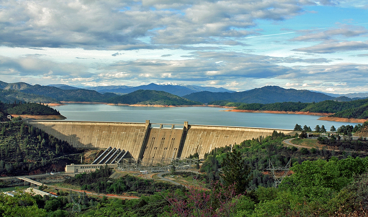
The Reimagining California Water Conference pursued the water journey from the high-mountain headwaters of the Sierra Nevada to the vast groundwater basins in the valleys below. Over the last century, the mountains were blanketed with snow each winter, storing water that melted slowly in the spring and summer to provide a reliable source of water for farming and communities below. However, climate change is telling a new tale. Warmer weather means less snow and more rain will fall on the mountains during the winter. The quick runoff must be managed in a way that preserves it for use in the summer.
“We need groundwater recharge because we're losing the snow pack quicker than we thought we would,” Bales said.
The new California water narrative has prompted scientists and policy makers to take a serious look at the potential for “flood-managed aquifer recharge” or Flood-MAR. Flood-MAR is a management strategy that uses water from rain or snowmelt to flood agricultural lands and working landscapes, such as refuges, floodplains and flood bypasses.
Successful implementation of Flood-MAR requires the identification of land for groundwater recharge, understanding the economic and agronomic impact of using agricultural land for recharge, and impacts of high-volume recharge on groundwater quality. But the potential is enormous.
“The state's underground basins are capable of storing 500 million acre-feet of water,” said Graham Fogg, UC Davis professor of hydrogeology. “That's like 500 Folsom reservoirs.”
Though the enormity of rewriting the California water story might seem an insurmountable challenge, panelist Debbie Franco noted that the passage of Sustainable Groundwater Management in 2014 happened when the state's unsustainable reliance of groundwater spiked during the 2011-2016 drought, reducing municipal water quality, drying domestic wells and causing land to sink.
“What seems impossible, after four years of drought, can be possible,” Franco said. “What will be the next thing? Get a sense of the solutions now.”
New dust sources resulting from a shrinking Salton Sea have negative ecological and health impacts

Scientists at UC Riverside investigating the composition of particulate matter (PM) and its sources at the Salton Sea have found that this shrinking lake in Southern California is exposing large areas of dry lakebed, called playa, that are acting as new dust sources with the potential to impact human health.
“Playas have a high potential to act as dust sources because playa surfaces often lack vegetation,” said Roya Bahreini, an associate professor of environmental sciences, who led the research project. “Dust emissions from playas increase airborne PM mass, which has been linked to cardiovascular disease, respiratory disease, and mortality.”
Study results appeared recently in Environmental Science and Technology.
Bahreini's team set out to test whether emissions from playas change the composition of PM10 (particulate matter with diameters up to 10 microns) near the Salton Sea. The team assessed the composition of playa soils (recently submerged underneath the Salton Sea), desert soils (located farther from the sea), and PM10 collected during August 2015 and February 2016.
They found that dust sources contributed to about 45 percent of PM10 at the Salton Sea during the sampling period while playa emissions contributed to about 10 percent. Further, they found that playa emissions significantly increased the sodium content of PM10.

Her team also found that playa soils and PM10 are significantly enriched in selenium relative to desert soils.
Bahreini explained that selenium can be a driver of aquatic and avian toxicity. “Additionally, higher selenium enrichments in PM10 during summertime suggest that selenium volatilization from the playa may become an important factor controlling the selenium budget in the area as more playa gets exposed,” she said.
Alexander L. Frie, a graduate student in environmental sciences and the first author of the research paper, urges that the Salton Sea be paid close attention since, although it is widely considered a large ecological disaster, with no serious monitoring and remediation efforts the sea may also create a human health crisis for the surrounding area.

Samantha C. Ying, an assistant professor of environmental sciences and a coauthor on the paper, stresses that monitoring the increase in dust sources over time is necessary to quantify its contribution to local health problems.
“Our study shows that the shrinking Salton Sea is contributing to dust sources in the region,” she said. “Even considering just the small area of playa that is exposed now, the contributions are significant.”
Another concern the researchers point out is that water that is currently diverted from the Colorado River and directed into the Salton Sea is scheduled to end before 2018. The resultant decrease of inflow into the sea will likely cause a decline in water level, exposing more playa, and therefore emitting more dust.
“With more playa being exposed, we expect total PM10 concentrations to increase and human exposure to these particles in downwind areas will also increase,” Bahreini said. “Therefore implementing any project, for example, creating shallow water pools over the playa, that limits formation of salt crusts on the playa will be valuable.”
Bahreini, Frie and Ying were joined in the study by Justin H. Dingle, a graduate student in Bahreini's lab.
The study was funded by UCR Regents' Faculty Development Award, USDA National Institute of Food and Agriculture, a UCR Provost Research Fellowship, the U.S. Geological Survey and ANR's California Institute for Water Resources.
Read more:
KPBS, David Wagner New Study Traces Airborne Dust Back to Shrinking Salton Sea
The Desert Sun, Ian James Studying dust around the Salton Sea, scientists find initial answers
Palm Desert Patch The Hidden, Potentially Deadly, Dangers of The Salton Sea
El Niño expected to drench California
Climate scientists refer to the anomaly as ENSO, for El Niño Southern Oscillation. The term describes the fluctuations in temperature between the ocean and atmosphere in the east-central Equatorial Pacific, just west of the Peruvian coast. The area is roughly between the International Date Line and 120 degrees west.
The ENSO cycle has three distinct phases: El Niño, La Niña and neutral. El Niño is defined when sea surface temperature is unusually warm for an extended period of time. La Niña is declared when equatorial Pacific is unusually cool for an extended period of time. Neutral phase is defined when the sea surface temperature is considered normal.
These large-scale changes in the surface water temperatures are linked to changes in the strength of the trade winds blowing from east to west across the region, which impacts weather patterns across the globe.
According to the NOAA Climate Prediction Center and International Research Institute for Climate and Society, a strong El Niño will continue through the Northern Hemisphere during the winter of 2015-16, followed by weakening and a transition to ENSO-neutral during the late spring or early summer.

Some of the expected outcomes are:
- Increased risk of flooding for California, since most of the precipitation is expected in the form of rainfall, rather than snow. Increasing streamflow in undammed rivers and quick filling of reservoirs that come with the potential for reservoir releases for flood control.
- Early bud breaking in many agricultural crops due to warmer than usual conditions. This can have significant yield impact on crops that rely on sufficient chill for proper development, such as citrus, apples, tree nuts and grapes.
- Increased aquifer recharge through so-called groundwater banking.
UC Agriculture and Natural Resources researchers will continue to monitor the El Niño Southern Oscillation and how it influences weather patterns in California. Future articles will provide detailed discussions on El Niño, with a focus on water resources impacts, effects on crops and potential for groundwater recharge.
An initiative to improve California water quality, quantity and security is part of the UC Division of Agriculture and Natural Resources Strategic Vision 2025.
Authors: Tapan Pathak, UC ANR Cooperative Extension specialist in climate adaptation in agriculture and Samuel Sandoval Solis, UC ANR Cooperative Extension specialist in water resources
