Posts Tagged: fire
Car fumes, weeds pose double-whammy for fire-loving native plants
Wildflower displays threatened
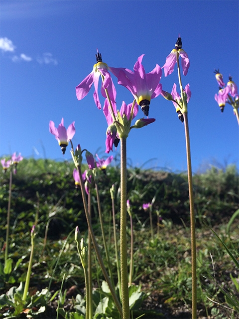
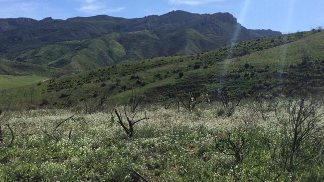
Northwest of Los Angeles, springtime brings native wildflowers to bloom in the Santa Monica Mountains. These beauties provide food for insects, maintain healthy soil and filter water seeping into the ground – in addition to offering breathtaking displays of color.
They're also good at surviving after wildfire, having adapted to it through millennia. But new research shows wildflowers that usually would burst back after a blaze and a good rain are losing out to the long-standing, double threat of city smog and nonnative weeds.
A recent study led by Justin Valliere, assistant professor in the UC Davis Department of Plant Sciences, found that native wildflowers and other plants that typically flourish following a fire were, instead, replaced by invasive plants on land that received the kind of nitrogen contained in vehicle emissions.
“Many native plants in fire-prone areas rely on fire, and some are entirely dependent on it. Some are even most abundant after a fire,” said Valliere, a UC Cooperative Extension specialist in invasive weed and restoration ecology. “But we found that these fire-following species may be especially vulnerable to the combination of nitrogen pollution and invasive plants.”
That's part of the reason why native plants in these mountains have been declining.
Seeds – banked in the soil and waiting to sprout
The problem faced by native plants can be compared to a drawn-down bank account: Funds withdrawn are not being replaced.
It starts with fire, an important ecological process, Valliere said. Flames burn through plants on the surface and return their nutrients to the soil. Seeds sleeping in the ground wait for the next rain to sprout, then use those nutrients to grow.
“Plant diversity is often highest in growing seasons immediately after a site burns,” he said.
But invading plants have many advantages over native ones. They often sprout earlier, grow faster and create more seeds, all while tolerating drought.
“They're like cheaters,” Valliere said. “They don't follow the same rules.”
Nitrogen, too, is an important piece of every plant's nutrition. They all get a fertilizing boost from nitrogen that floats up in vehicle emissions and falls to the ground. But the invaders use nitrogen and other nutrients to grow faster, winning the race for water and sunlight. As a result, fewer native plants reach maturity, producing fewer seeds that keep their populations thriving.
When the bank balance reaches zero
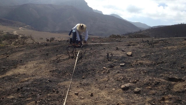
The 2013 Springs Fire gave Valliere a unique opportunity to study the combined impacts of wildfire and extra nitrogen. He and colleagues from UC Riverside and the National Park Service created test plots in the Santa Monica Mountains where the fire had burned. Then, they added nitrogen to the soil to mimic the amount and type that LA's smog would deposit. Over the study's three years, native plants that typically would have flourished after wildfire instead declined even faster in the plots with added nitrogen.
Native seeds sprouted, but didn't flower. Over time, the soil's bank of seeds drew down.
“Each seed has one chance to flower and reproduce,” Valliere said. “If a seed grows and gets outcompeted, that seed has lost its chance to replenish the seed bank.”
Without the chance to replenish their bank account, native plants will die out, and the whole ecosystem will be thrown out of balance.
“There is inherent value in biodiversity,” Valliere said. “These invasive weeds could prevent the re-establishment of native shrubs after fire, sometimes forever altering the plant community.”
The loss of native plants can have cascading effects on the larger environment, he added. Problems can include the loss of native bees that feed on the flowers, and mudslides when rain makes hillsides unstable.
This problem is likely to repeat in similar areas where biodiversity is highest after wildfires – including parts of the Mediterranean basin, southern Africa and Australia. The addition of city smog “could have serious consequences for the biodiversity of fire-prone ecosystems worldwide,” Valliere warned.
Read the paper, “Nitrogen deposition suppresses ephemeral post-fire plant diversity,” by Justin Valliere, Irina Irvine and Edith Allen.
This article was first published on the UC Davis Department of Plant Sciences website.
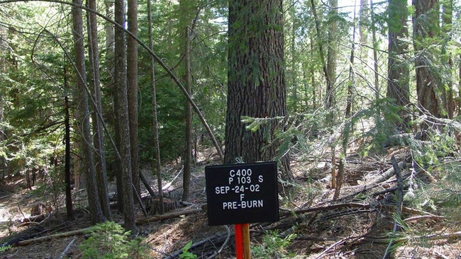
20-year study confirms California forests are healthier when burned or thinned
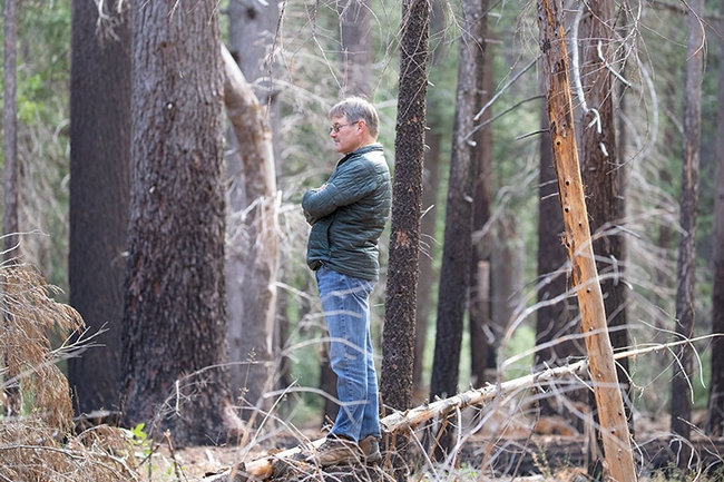
Surrogates to wildfire
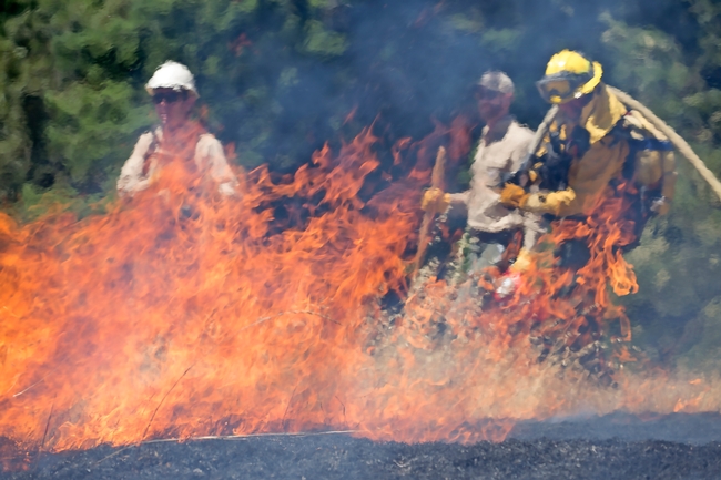
Trial by fire
More than 800 wildland fire professionals gather for international conference in Monterey
UC ANR among sponsors of 10th International Fire Ecology and Management Congress
Scientists, land managers, educators and students from a variety of organizations worldwide will gather from Dec. 4-8 in Monterey, California for the 10th International Fire Ecology and Management Congress. The conference is hosted by the Association for Fire Ecology in cooperation with the California Fire Science Consortium.
Major sponsors include University of California Agriculture and Natural Resources, with the Esselen Tribe of Monterey County as the host tribe. There are more than 25 additional sponsors and exhibitors representing federal and state agencies, universities, nonprofits, tribal organizations and companies.
“As we know from recent fire events across the globe, wildland fire issues are complex and there is an urgent need to work together in new and creative ways to address wildfire-related challenges,” said Lenya Quinn-Davidson, Fire Network director at UC ANR. “We need to identify opportunities to promote fire-resilient communities and environments.”
This event will include workshops, field trips and three full days of presentations, discussion groups and networking opportunities around the theme, “Igniting Connections: Celebrating Our Fire Family Across Generations, Cultures and Disciplines.”
On Monday, Dec. 4, the Fire Congress will kick off with 10 workshops and trainings, offering opportunities for participants to build and apply new skills in modeling, collaborative planning, risk management and more. From Tuesday morning to Thursday afternoon, the Fire Congress program is filled with innovative plenary sessions, more than 500 oral and poster presentations, and opportunities for sharing information through discussion groups and meetings.
For the first time, the conference will also feature an Indigenous Culture and Art Showcase, taking place on Tuesday, Dec. 5. The entire event concludes on Friday, Dec. 8 with field trips to explore nearby natural areas to see how the concepts discussed at the Fire Congress are being applied in California.
Participants will be encouraged to share and explore proactive solutions that apply Western science and Indigenous knowledge to meet desired management and societal outcomes.
More conference information at http://afefirecongress.org.
MEDIA CONTACTS
Lenya Quinn-Davidson (University of California Agriculture and Natural Resources): lquinndavidson@ucanr.edu, 707-272-0637
Morgan Varner (Tall Timbers Research Station): mvarner@talltimbers.org, 707-845-1659
Jeffrey Kane (Cal Poly Humboldt): Jeffrey.Kane@humboldt.edu, 928-637-4128
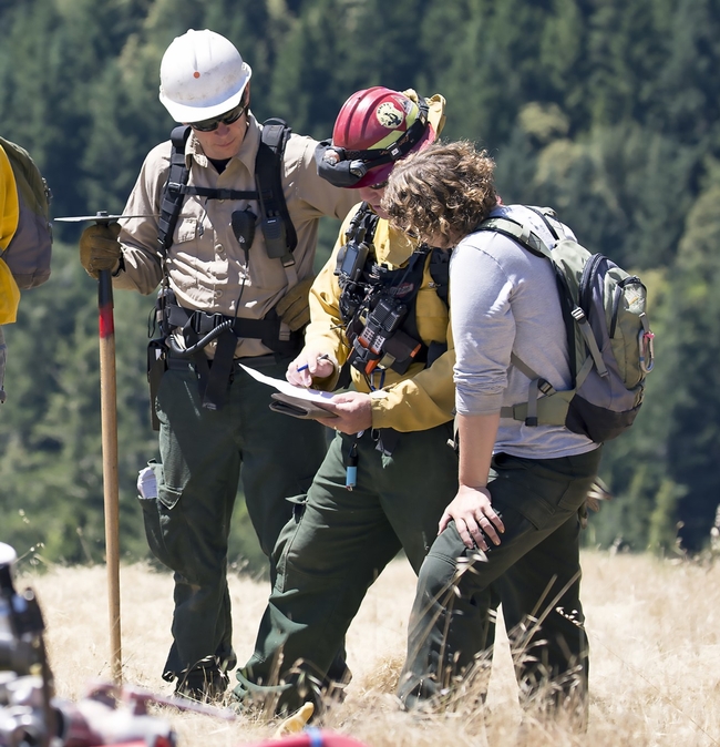
Reforms needed to expand prescribed burns
Study highlights 4 strategies to overcome barriers to prescribed fire in the West
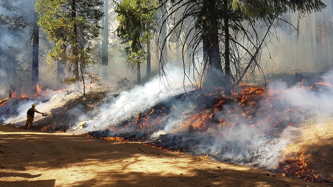
Prescribed fire, which mimics natural fire regimes, can help improve forest health and reduce the likelihood of catastrophic wildfire. But this management tool is underused in the fire-prone U.S. West and Baja California, Mexico, due to several barriers.
A paper from the University of California, Davis, pinpoints those obstacles and suggests four key strategies that policymakers and land managers can take to get more “good fire” on the ground in North America's fire-adapted ecosystems. The paper also provides examples of how people are surmounting some of these obstacles.
“Prescribed fire is one of the most important tools we have for restoring natural fire regimes and undoing the effects of a century of fire suppression,” said lead author John Williams, a project scientist with the UC Davis Department of Environmental Science and Policy. “But there are a number top-down barriers at the upper levels of management that keep us from growing the workforce and getting burns done at the scale and extent needed. We point out some of the big ways that agency leaders and policymakers can dismantle those barriers and empower the full range of people capable of doing this work, from burn bosses and citizen-prescribed burn associations to nonprofits and tribal groups.”
The paper, published in the journal Frontiers in Ecology and the Environment, centers on the North American Mediterranean climate zone, which includes most of California, southwestern Oregon, western Nevada and northern Baja California in Mexico. Lenya Quinn-Davidson, director of UC Agriculture and Natural Resources' Fire Network, is a co-author of the paper.
A natural process
Fire is a natural process that has helped shape this region, but the area has experienced a spike in destructive, high-severity wildfires over the past decade. In fact, three of the five largest wildfires in continental U.S. history occurred in this region in just the past five years. This is due to a combination of climate change and fuel accumulation driven by a century of policies that encouraged fire suppression, curtailed Indigenous cultural burning, and favored harvest of the largest, most fire-tolerant trees, the study notes.
While scientists and resource managers recognize the need for more prescribed fire, its application has not kept pace with the enormity of the challenge. The study said that is because management policies prioritize fire suppression over prevention. There is also a limited fire workforce; regulatory hurdles like permitting, insurance and liability; and few incentives or protections for landowners, tribal members and other people who burn responsibly.
4 key strategies
Researchers identified four key areas where supportive institutional and agency leadership can help expand prescribed fire in the region:
1) Fire culture. After decades of emphasizing wildfire suppression, current fire management culture “does not adequately promote prescribed fire as a management tool,” the study said. Support for prescribed fire along the entire chain of command within agencies is needed to foster a new culture that incentivizes and enables prescribed fire practitioners within and outside of government agencies.
2) Funding. Prescribed fire is considerably more cost-effective than wildfire suppression, which can cost more than $2 billion a year in the U.S., but there is little dedicated funding for prescribed fire projects and lack of flexibility as to when such money can be spent. This impedes fire staffing and limits the kinds of projects that can be done. Year-round, dedicated funding and resources could help increase prescribed fire capacity.
3) Capacity building and cooperation. Connecting agencies with landowners, community members, tribes, prescribed burning associations (PBAs), prescribed fire training exchanges (TREXs) and others can facilitate responsible, effective prescribed fire and cultural burning exchanges. Such groups have limited reach and require investment and support to meet demand.
Inter-organizational agreements can also help local, state and federal agencies share resources and staffing. Formalizing and fully integrating such agreements into fire management plans remains a challenge, the study said. Collaborations that support Indigenous cultural burning are also key.
Partnerships must recognize the unique dimensions of cultural burning, which are inseparable from Indigenous culture. Educating land managers and decision makers about tribal sovereignty and federal American Indian law is critical. Introducing legislation that supports cultural burning can also foster such collaborations.
4) Monitoring and adaptive management. Designated funding and personnel for quantitative monitoring after a prescribed burn can help practitioners better measure success and then apply lessons to future burns.
“All of the barriers identified in the study can be overcome, and they have been at least partially resolved in other parts of the U.S., as well as in other Mediterranean climate regions, such as southwestern Australia,” said co-author Hugh Safford, a research ecologist in the UC Davis Department of Environmental Science and Policy and director of the California Prescribed Fire Monitoring Program. “Fundamental to setting the situation right is developing a culture of safe and regular fire use in California and neighboring states by all landowners and managers, and reducing the officiousness, risk aversion and bureaucracy that hinders access to the tool by the public.”
Additional co-authors include Ashley Grupenhoff and Beth Rose Middleton of UC Davis; Joe Restaino of CAL FIRE; Edward Smith of The Nature Conservancy; Chris Adlam of Oregon State University; and Hiram Rivera-Huerta of Autonomous University of Baja California, Mexico.
This research received financial support from the California Department of Forestry and Fire Protection (CAL FIRE).
This story was originally published on the UC Davis News site.
4-H youth project helps Siskiyou County prepare animals for emergencies
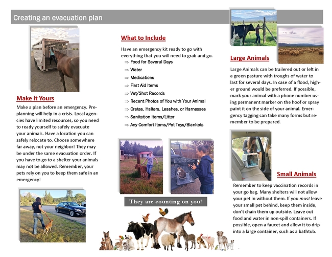
Planning brochure for pets, livestock fills crucial need as fires an increasing threat
With the McKinney Fire creeping closer to Yreka in the summer of 2022, Emily Jackson and her mother potentially faced the enormous task of getting all their goats, chickens, dogs and cats to safety – while Emily's father and twin sister Lindsay were away fighting the fires.
Fortunately, Emily and Lindsay had gained crucial knowledge about evacuating animals through a 4-H service-learning project they helped lead in 2018. A group of eight 4-H youths, ages 14 to 18, had created a “Pet Emergency Evacuation Plan” (PEEP) brochure, aimed at educating their neighbors in Siskiyou County about the necessary preparations for livestock and pets.
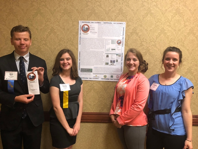
The brochure, available through the Siskiyou County website, remains in use today in this densely forested region that saw another spate of wildfires this summer. The PEEP project team was composed of Kylie Daws, Emily Jackson, Lindsay Jackson, Will Morris, Madison Restine, Maryssa Rodriguez, Emily Smith and Callahan Zediker.
Within those stressful hours in 2022 when the McKinney Fire prompted an evacuation warning during which residents could be required to leave at any moment, Emily Jackson said she and her mother had a game plan in place – thanks to her work on the PEEP project.
“At the time, it wasn't even on my mind,” Jackson said, “but looking back now, I know that having the experience from making that brochure was driving my thought process at the time.”
And while the Jackson family and their neighbors ultimately were not asked to evacuate in 2022, many community members have benefited from the hundreds of copies of the PEEP brochure in circulation, which prompts residents to at least think about what their animals would need in an emergency, Jackson said.
Pet and livestock evacuation tips were needed
Such a resource previously had not been available among the county's emergency preparation materials, according to Jacki Zediker, the 4-H regional program coordinator in Siskiyou County who advised the PEEP project group.
“One piece that was missing was how to help our communities understand that when they evacuate, and they take their pets with them…it's not as simple as just taking their pets with them,” said Zediker, citing the example that some shelters do not take in animals – or do not take animals without proof of vaccination.
Other items to add to the pet's emergency kit include food for several days, water, medications, comfort items or toys, and recent photos of the owner with their animal (proof of ownership).
Zediker had connected the young people with Jodi Aceves, senior deputy agriculture commissioner/sealer for Siskiyou County, who had been overseeing the county's Animal Control programs and emergency response.
“There's a lot of information out there for people evacuating, but not necessarily for livestock and pets,” Aceves said. “Unfortunately, we have had some fires where there were lots of pets and livestock lost.”
She met several times with the 4-H group, discussing the county's evacuation systems and processes and the role of the Office of Emergency Services and law enforcement agencies, and sharing key considerations in preparing for emergencies – such as having a pre-agreement in place with someone who could house an evacuee's animals.
Aceves praised the teens for distilling the vital information into a short and simple brochure that community members could easily read and remember. She also was impressed by the energy and genuine care that the young people put into the project.
“Most of their lives, every summer, they've been in fire,” Aceves said. “It's close to their hearts, and they've seen a lot of their neighbors and other people in the county either affected by fire or evacuated at some point.”
For Lindsay Jackson, in particular, fire and serving the community have been lifelong passions, inspired by her father's work in the area.
“My dad was a volunteer fire chief for the South Yreka Fire Department; he was doing that since I was about two or three, so I grew up watching him go to the trainings, go to a call,” she explained. “When I was 15, I joined the fire department as a cadet to help out with the medical side, but the more I volunteered, I really liked the fire side, too.”
Jackson added that Zediker has a special knack for nurturing and encouraging the interests of the 4-H participants and applying them in a productive way.
“Jacki was really good at figuring out where our passions were and then how we could put our passions into a service-learning project,” she said. “She knew I was really big into fire and helping the community in that way since I was young.”
Zediker also helped the Jackson twins on their senior project, a fire-safety field day at the South Yreka fire station. More than 100 schoolchildren learned fire safety basics, met firefighters and emergency personnel, and heard about 4-H from Lindsay and Emily.
4-H experiences, mentorship inspire career paths
The PEEP project group also was asked by several organizations to share their knowledge about emergency preparations for animals. In addition to presenting a poster about their work at the 4-H California Focus conference in 2018, the group handed out the brochure and shared information at a table during a Juniper Flat Fire Safe Council workshop and resource fair.
Beyond distributing the PEEP brochure at 4-H club meetings, school events and community meetings, the youths have lent their voices to advocating for emergency resources for animals. Zediker noted that they contributed testimonials that helped the county acquire grants for purchasing more portable kennels.
But the most enduring impact of 4-H participation and community service, however, is that those experiences were a springboard for the young adults' careers. Emily Jackson – who participated in 4-H from age 5 to 19 – is now working toward a master's degree in biology at Cal Poly Humboldt, studying how fire suppression and other factors have changed plant communities in the Russian Wilderness.
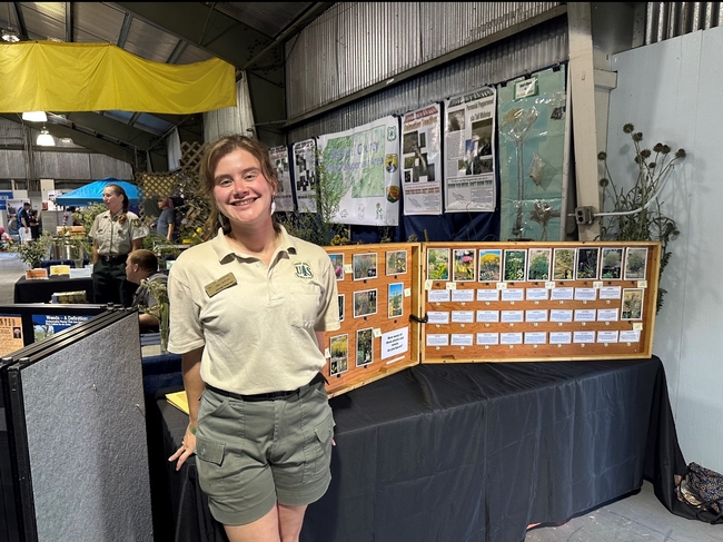
Whether training colleagues as a U.S. Forest Service crew lead for the past couple of summers, or leading lab sections in general botany as a graduate student, Jackson said she draws on her 4-H experiences – and Zediker's inspirational example – as she pursues a career in teaching.
“In my development as a young adult into an adult now, I cannot overstate how big of a role Jacki played in that,” Jackson said.
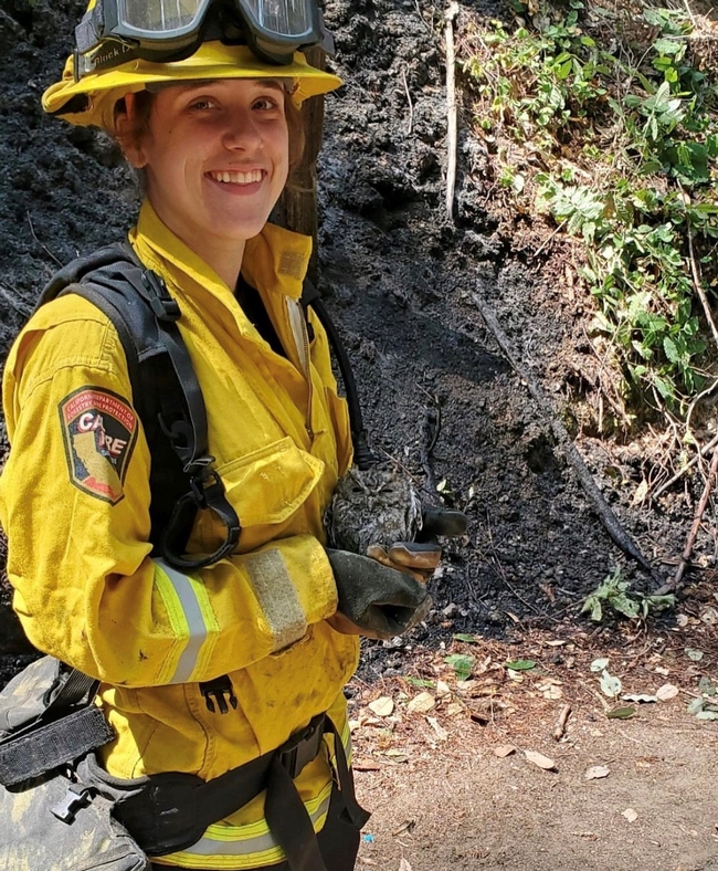
Her sister Lindsay, meanwhile, has pursued her passion for fire all the way through the fire academy at College of the Siskiyous, where she also earned her emergency medical technician (EMT) license. Most recently working on fires near Pondosa in Siskiyou County, Jackson has been a seasonal firefighter based at the McCloud CAL FIRE station since 2020.
“It's hard because, in the last three years, I haven't left Siskiyou County, there's just been so many fires here,” she said. “But it's nice being able to help your community and know you're making a difference.”
Lindsay Jackson intends to pursue a bachelor's degree in leadership studies at Cal Poly Humboldt in hopes of getting a full-time position with CAL FIRE.


