Posts Tagged: Center for Watershed Sciences
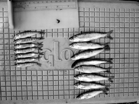
Frolicking fat floodplain fish feed furiously
A very wet spring brought a good deal of water to the floodplains this year—good news for juvenile salmon that thrive in this habitat. Floodplains — such as the Yolo and Sutter Bypass areas and the Cosumnes River floodplains — provide a link for juvenile salmon between the gravel bedded rivers where they hatched and the ocean where they will spend the next one to five years.
Although salmon may only use the floodplain for a month or two, this could mean the difference between success and failure in their long journey to the ocean and back again. When juvenile salmon spend time on the floodplain, they grow faster than those that use only the river channel during their migration to the ocean (Sommer et al. 2001, Jeffres et al. 2006). Because of the increased growth, the juveniles are larger when they head out to sea; they can survive better by swimming faster and being more able to avoid predators.
What makes a floodplain a good place for rearing salmon? First of all, it needs to be connected to the river. This sounds obvious, but most of the floodplain habitat in California is isolated behind levees and only gets flooded during extreme high water events when the levees are overtopped or breached. The reason that the levees are there is to protect housing and agricultural land (orchards, vineyards, etc.), which doesn’t allow for regular inundation of floodwaters.
Why are these multi-purpose floodplains better than the river channel for rearing salmon? As cold floodwater enters a floodplain from the river, it spreads out, slows down and deposits sediment. Throughout this process, the water also warms slightly. This is essentially the priming of the productivity pump that will ultimately feed the juvenile salmon for the next couple of months. As the water slows, clears and warms, phytoplankton and algae begin to grow. Populations of animals that feed on the fast-growing plant life, such as zooplankton and other aquatic invertebrates boom. These animals comprise the main food of juvenile salmon on the floodplains.
Because salmon are cold blooded, water temperature it is an important component to floodplain suitability. If water is too cold, juvenile salmon are lethargic and growth is slow. If the water is too warm it causes increased metabolic demands and reduced dissolved oxygen, inhibiting growth and increasing mortality. Fortunately for California salmonids, out-migration is in the spring when temperatures are generally moderate. The timing of spring high flows onto floodplains allows for ideal temperatures for juvenile salmonids compared to the relatively cold water in the main river channel. When temperatures are good and food is abundant, juvenile salmon can grow at impressively fast rates, especially when compared to fish using the main river channel.
The combination of complex physical processes and ecological function is what separates the floodplain from the river corridor in the eyes of juvenile salmon. Leveed river channels provide little complexity and less than ideal growing conditions during the annual spring out-migration. When juvenile salmon have access to complex floodplain habitats where temperatures are good and food resources are abundant, they will grow to larger sizes and thus be able to survive better than fish that remained in the main river channel.
So, next time you catch a big healthy salmon, thank your local floodplain.
Further Reading:
Jeffres, C., J. Opperman and P. Moyle (2008), “Ephemeral floodplain habitats provide best growth conditions for juvenile Chinook salmon in a California river,” Environmental Biology of Fishes 83 (4): 449-458.
Sommer, T., B. Harrell, M. Nobriga, R. Brown, P. Moyle, W. Kimmerer and L. Schemel (2001), “California’s Yolo Bypass: Evidence that flood control can be compatible with fisheries, wetlands, wildlife and agriculture,” Fisheries 26 (8): 6-16.
New life for the delta ecosystem
The San Joaquin/Sacramento Delta and Suisun Marsh were once part of a continuous, enormously productive aquatic ecosystem that supported dense populations of fish from Sacramento perch to salmon, huge flocks of wintering waterfowl, and concentrations of mammals from beaver to tule elk. This amazing ecosystem is gone and cannot be brought back.
The once vast marshes have been turned into farmland and cities, protected by a complex system of levees. The patchy remnants of the original ecosystem are disappearing fast, as more and more native plants and animals become extinct or endangered. In their place, hundreds of alien species thrive in the altered conditions—crabs, clams, worms and fish from all over the world.
- We have a choice. We can let the ecosystem continue to slide towards being a mess of alien species that live in unsavory water flowing through unnatural pathways, or we can take charge and create a new ecosystem that contains the elements we want. Those elements include native species and clean water that flows in more natural patterns, creating a better environment for fish and people.
The State Water Resources Control Board recently supported this concept by recommending that much more fresh water flow through the estuary to the ocean to create a sustainable estuarine ecosystem. More water is only part of the recovery picture, however, because the flows must be managed in new ways and flow through restored habitats. The historical ecosystem can be used only as a model for the new system, mainly to identify conditions that favor remnant native species and have other desirable features. But the new ecosystem will be quite different in its locations, its biota, and how it works.
High variability in environmental conditions in both space and time once made the upper San Francisco Estuary highly productive for native biota, so variability is clearly a key concept for our new ecosystem (Moyle, et al. 2010). Achieving a variable, more complex estuary requires policies that create the following conditions:
- Internal Delta flows that create a tidally-mixed, upstream-downstream gradient in water quality, with minimal cross-Delta flows. At times much of the water in the present Delta flows towards the big export pumps in the South Delta. Fish trying to migrate upstream or downstream find this very confusing, often lethally so.
- Slough networks with more natural channel geometry and less diked, rip-rapped channel habitat.
- More tidal marsh habitat, including shallow (1-2 m) sub-tidal areas, in both fresh and brackish zones of the estuary.
- Large expanses of low salinity (1-4 ppt) open water habitat in the Delta.
- A hydrodynamic regime where salinities in the upper estuary range from near-fresh to 8-10 ppt periodically to discourage alien species and favor desirable species.
- Species-specific actions that reduce abundance of non-native species and increase abundance of desirable species, such as active removal of undesirable clams and vegetation.
- Abundant annual floodplain habitat, with additional large areas that flood in less frequent wet years.
- Treating the estuary as one inter-connected ecosystem, recognizing that changes in one part of the system will likely effect the other parts.
These habitat actions collectively provide a realistic, if experimental, approach to improving the ability of the estuary to benefit desirable species. Some of these goals are likely to be achieved without deliberate action as the result of sea level rise, climate change, and failure of unsustainable levees in some parts of the Delta. But in the near term, habitat, flow restoration and export reduction projects can allow creation of a more variable and more productive ecosystem than now exists, while accommodating irreversible changes to the system.
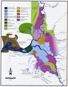 What a multi-purpose, eco-friendly delta could look like. Click on the image to view an interactive form of the map that lets you see descriptions of what each area might look like in a future eco-friendly delta.
(This post first appeared on the CaliforniaWaterBlog.)
Update: The National Research Council has taken an interest in plans to conserve habitat for endangered and threatened species in the Sacramento-San Joaquin Delta while continuing to divert water for agricultural and urban use in Southern California. On May 5, the council declared the draft Bay Delta Conservation Plan incomplete, difficult to understand and still needing much work.
Further Reading:
Moyle, P.B., J.R. Lund, W. Bennett and W. Fleenor (2010), Habitat Variability and Complexity in the Upper San Francisco Estuary, San Francisco Estuary and Watershed Science 8(3).
Cunningham, L. (2010), A State of Change: Forgotten Landscapes of California, Heyday Books, Berkeley.
Agricultural water conservation — a serious look
With this latest set of storms replenishing California’s snowpack and water levels in reservoirs, rivers and streams, it may be hard to think about water conservation issues. But this is a still a semi-arid state, so it is always prudent to prepare for droughts.
So where can we save the most water? Farming in California depends on irrigation, so agriculture seems the largest potential source for cost-effective water savings in the state. Although agriculture’s share has been declining, it still accounts for roughly 75 percent of all human water use, compared to 25 percent for urban uses.
The recent book, Managing California’s Water: From Conflict to Reconciliation, examines agricultural water conservation extensively and points out the complexity of this issue. The book’s findings are based on scientific and economic research and field experience in California and worldwide.
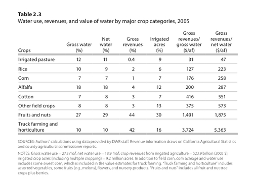
Much agricultural water is still devoted to relatively low-value crops: In 2005, over 60 percent of “net” water use in the agricultural sector – the amount consumed by crops – was for irrigation of pasture and field crops such as alfalfa, corn, rice, and cotton, which generated only 14 percent of crop revenues. These statistics imply significant potential for reducing farm water use without incurring overwhelming consequences for the state’s economy.
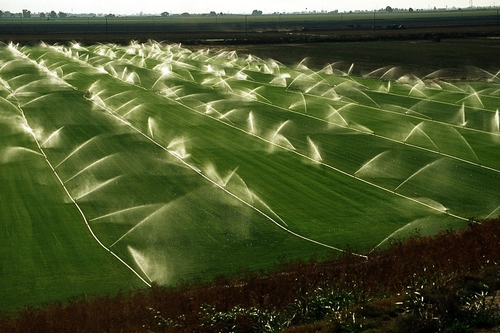
Contrary to popular understanding, however, improving on-farm irrigation efficiency is usually a poor way to achieve real agricultural water savings. Real conservation usually requires shifting to crops that use less water or reducing crop production, such as by fallowing farmland. This is because much of the irrigation water applied when farmers use “inefficient” techniques like furrow irrigation is returned to streams or aquifers, where it becomes available for reuse.
This is the international scientific consensus on irrigation conservation, from studies worldwide. Most groundwater recharge in California’s Central Valley is from irrigation runoff and percolation. This recharge helps to replenish depleted aquifers and serves as a significant source of supply during drought. Only a few areas in California, such as the Imperial Valley, can save large amounts of water by adopting more efficient irrigation techniques. In such areas, the excess irrigation water flows into saline water bodies or contaminated aquifers, where it is unavailable for reuse, so reducing runoff generates real water savings.
Even though improving irrigation efficiency usually does not produce significant real water savings, it can provide economic benefits for farmers. Farmers usually pay for the amount of water they apply to their fields, not the amount consumed by crops. When farmers face limited supplies, they often have an incentive to adopt more efficient techniques, such as drip irrigation, to make use of every possible drop on their farms.
These techniques, often combined with laser leveling of fields and more precise doses of fertilizers and pesticides, can improve crop productivity and quality. In recent decades, many San Joaquin Valley farmers have made such changes, which have enabled them to plant greater acreages of higher-value fruit, nut and vegetable crops.
Improving irrigation efficiency also can provide environmental benefits. For instance, agricultural runoff sometimes contains harmful salts and other chemicals, and more efficient irrigation can help reduce these discharges. This is another reason for the rise in more efficient irrigation techniques on the west side of the San Joaquin Valley, where farmers are required to limit runoff of selenium, a toxin to wildlife. Similarly, by reducing diversions, irrigation efficiency may allow higher streamflows on particular stretches of rivers, improving conditions for aquatic life.
Although counterintuitive, more efficient irrigation techniques also can increase water consumption. By allowing farmers to farm their fields more intensively and to expand irrigated acreage with the water they “save,” techniques like drip irrigation can increase net farm water use within a region, thereby reducing groundwater recharge and nearby streamflow. Conservation-oriented policies that neglect this possibility can exacerbate groundwater overdraft, as studies from New Mexico to Yemen have shown.
What is the right policy to encourage effective agricultural water conservation? It depends on the objective. To encourage real water savings, the best policy is to let market forces work. Water markets are a flexible and efficient way to encourage farmers to create real water savings for higher-valued uses. California needs to improve the ability to buy and sell water, by reducing state and local barriers, to give farmers better price signals. To reduce polluted agricultural runoff or improve streamflows in some areas, the best policy is to adopt regulations that directly address pollution discharges and instream flows, and allow farmers to choose the most cost-effective way to meet these requirements.
In contrast, policies that impose particular irrigation technologies, or even ban specific crops, are likely to impose higher costs on farmers and society, while failing to save real water. Given the immense variety and variability of conditions in California, rigid regulatory policies to promote agricultural water conservation seem more likely to create more controversy and increased social cost than usable water savings.
Agricultural water conservation is an important part of California’s water future. But simplistic notions of water conservation threaten to mislead California’s water policy debates by presenting the false claim that water saved from on-farm use is necessarily water saved to the system. It is time to take water conservation seriously. In doing so, we also must undertake water conservation scientifically, rather than rhetorically.
(This post is excerpted from the California WaterBlog—“Taking Agricultural Conservation Seriously”.)
Jeffrey Mount and the Delta levee blues
Jeffrey Mount, a UC Davis geology professor and the Roy J. Shlemon Chair in Applied Geosciences, was included in “The Sacramento 100” — Sacramento News and Review’s 2010 round-up of the most influential, important and interesting people in Sacramento.
He was joined by an eclectic group of “interesting” characters, so whether being named on the list makes him notorious or famous is up to interpretation.
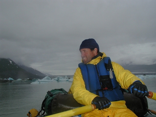
Jeff Mount
In any case, Mount was aptly described as “the man who knows everything about rivers in a region that owes its existence and continued survival to its rivers and Delta.”
As a local watershed expert and founding director of the UC Davis Center for Watershed Sciences, Mount was frequently called upon in the aftermath of the devastating levee breaks in New Orleans to estimate odds of a similar massive levee failure in the Delta.
The odds aren’t encouraging — Mount predicts a 64 percent chance of massive failure in the next 50 years. And some recent reports from the California Department of Water Resources suggest that is an optimistic estimate.
The strong late December storms sweeping through California had Mount keeping one eye on the levees and another on his kayak. So far this season, Californians have been lucky. But Mount doesn’t expect that luck to hold indefinitely.
The Sacramento-San Joaquin Delta supplies irrigation water for more than a million acres of agriculture in the Central Valley — some of the nation’s most productive farmland — and drinking water for two-thirds of California’s residents. But the levees that hold the Delta together are old and in crisis.
The 1,100-mile system of earthen embankments was built in the late 1800s and early 1900s to reclaim Delta marshland for farms. This creaky system of levees desperately needs a major overhaul. Over time, erosion, seepage and animal burrows have taken their toll. The levees have also been weakened by the gradual sinking of land behind the levees. Many of the Delta islands are now 25 feet below sea level.
Any major levee breach due to storm or earthquake could pull brackish ocean water into the Delta, contaminating irrigation and drinking water supplies and stopping the flow of water to the south and the Bay Area. Infrastructure such as rail lines, highways and gas pipelines would also be impacted.
The big picture of what could go wrong in the case of massive levee failure is scary if you stop and think about it, which has given Mount the name Dr. Doom in some circles. But Mount isn’t one to candy coat the situation. He was once quoted by a reporter that “New Orleans has lost the battle with the inevitable, and we will do the same.”
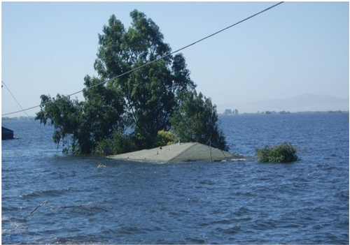
Jones Tract Flooding, 2004
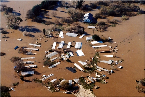
Flooding in Mossdale, 1997


