New mobile app identifies hazardous trees for public safety
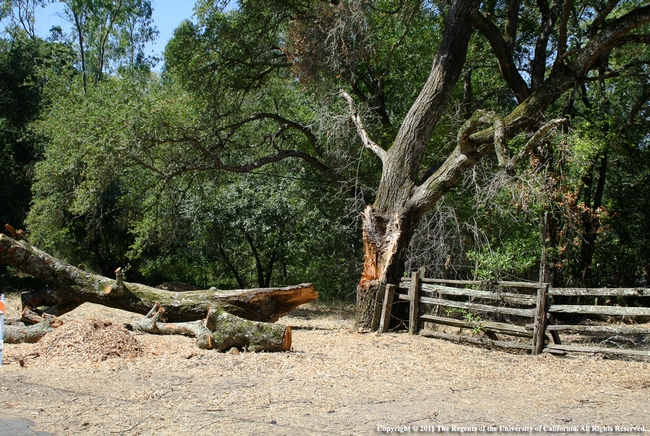
"Trees are poems that the earth writes upon the sky,” wrote Kahlil Gibran. But trees falling into power lines have sparked catastrophic fires and falling trees have injured nature lovers.
To prevent power outages, PG&E looks for trees near power lines that need to be trimmed or removed. To prevent power outages and other mishaps caused by failing trees, Matteo Garbelotto, UC Cooperative Extension forest pathology specialist at UC Berkeley, has incorporated science into a mobile application that can be used to determine whether a tree presents a hazard and should be removed.
“PG&E was doing tree surveys with pencil and paper,” said Garbelotto, who saw the manual process as fraught with opportunities for error. A paper record needs to be sent to a central collection site where it is transcribed. In the transcription process, mistakes can be made. And there's no way of verifying if a person actually examined the tree to fill out the form.
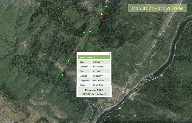
“Why don't you do a digital survey?” he asked a PG&E tree surveyor. “Using a tablet or phone, the data could be shipped directly, in real time, to the San Francisco office. Using a phone or GPS device, you will know the precise location of the tree and know the worker did the job. If there's a fire, you have proof.”
PG&E Corporation Foundation, the philanthropic arm of the utility, gave Garbelotto a $70,000 grant to develop the app he envisioned for determining which trees are hazards.
“Developed by dedicated UC Berkeley researchers, the tool will provide benefits for other utilities and the forestry industry as they work to create safe and healthy forests. The easy-to-use mobile platform collects data in real time and creates a record that the survey was completed including relevant details like “when,” “where” and “who,” said Stephanie Isaacson, director of community relations for PG&E.
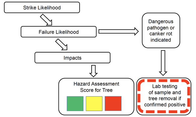
The UC Cooperative Extension tree disease expert created a list of questions that help evaluate tree health. For example, in addition to asking if the tree leaning toward a power line, surveyors are asked, Are there obvious signs of internal decay? Is there a large wound on the tree?
“If a tree has a wound of 5 inches or more, there is a good chance there is significant decay behind the wound,” Garbelotto said. “If there is a mushroom or conk growing on the tree, that portion of the tree is dead and the branch or whole tree may fall down.”
The app, which Garbelotto has dubbed “Evalutree,” can be used for more than powerline safety.
UC Berkeley Ph.D. student Michael Johnson has been using the app to evaluate different species of trees.
“We have just started our third field season using the app on a project for the Department of Defense that quantifies the health and economic value of the oak woodlands on the 100,000-acre Vandenberg Air Force Base,” said Johnson. “We started with coast live oak the first summer, added tanoak the second summer, and have expanded to bishop pine this summer.”
The mobile app has simplified data collection for Johnson, who is in the Forest Pathology and Mycology Lab at UC Berkeley.
“I used pencil and paper studying postfire aspen regeneration on Forest Service land in Northern Arizona in 2012-2013, where I also did my master's work on ponderosa pine decay in 2013-2015,” Johnson said.
He described his undergraduate work collecting data with pencil and paper carried in a tatum, a 8.5-inch by 12-inch metal case with a clipboard, compared with working with the Evalutree phone app.
“Each day would start with making sure that we had all of our data sheets packed in our bulky field tatums,” Johnson said, “making sure our GPS points were preloaded in a separate, expensive GPS device, making sure that our camera had batteries and that we had dry erase markers for our small white board so that we could indicate which plot each photograph belonged to.
“After the fieldwork was complete, we would spend weeks doing data entry, trying to make out the scrawled numbers and notes – smeared with charcoal and raindrops – and sorting and compiling the data, photos and GPS points. It was time-consuming and painstaking, to say the least.”
For his graduate research, Johnson was able to enter data directly into a spreadsheet on a field computer. “At the end of the field work, I would just have to compile the data from the computer, photos from the camera, and GPS points from the Garmin to make a report,” he said.
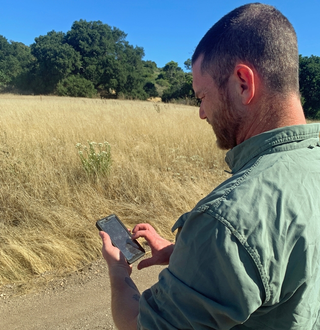
“Evalutree has changed all of that. Instead of field tatums and multiple bulky devices, I walk out into the field with a lab cell phone. The app has preloaded survey questions, the ability to connect photographs to specific plots, and drops GPS points at each plot and tree that I survey.”
Working in the U.S. Defense Department's sprawling, undeveloped landscapes, Johnson said, “We are often in the field all day without internet or phone connectivity. The app is prepared to meet this challenge and relies on our phone's internal storage and pre-existing GPS functionality to order and store our data with precision accuracy. At the end of the day – when we have returned to civilization and technology – we simply upload all of our surveys for the day and I immediately have my data and reports in multiple formats, including pdf, xls and kml files, at my fingertips.
“Within minutes, I can update my maps to show the exact location of all of the day's surveys, start crunching data in Excel, or print out a report with the photographs from each plot for my boss,” Johnson said.
Garbelotto, the UC Cooperative Extension specialist, would like to make the technology available to cities and companies that manage trees.
“The app can be used by any agency or government that owns or manages a significant number of trees and needs to run surveys on a regular basis to ensure these trees are not at risk of failing, causing property damage or, worse, casualties or injuries to people,” Garbelotto said.
“The surveys can be easily customized for different projects,” he said. “It can be used for campgrounds or parks to calculate the likelihood of a tree failing and likelihood of causing damage. You could have an answer within minutes of submitting the survey.”
For more information about Evalutree, contact Garbelotto.
This story was updated July 21 to add a quote from PG&E.
Comments:
Is this going to become publicly available at some point? I mean in MN alone with forest service parks and recreation areas, we could eliminate so many hazards and dangers that people notice but just go about their day. Is there a plan to move this project into the public sector?
Thank you for this Post and I look forward to hearing from you.
i want to get app.Have you any source or link?


Posted by Ryan F. Keiffer on July 9, 2020 at 10:49 AM