

Posts Tagged: forest
New videos demonstrate techniques and tools to survey forestland trees
Forestland owners can learn how to survey the trees on their property from four new videos produced by UC Cooperative Extension, setting them on a course for sustainable management of their forestland. The videos are available on the UC ANR YouTube channel (http://youtube.com/UCANR).
Learning the tools and techniques used for centuries by professional foresters and research scientists allows private forest owners to collect data that paints a picture of the land and trees' current condition.
“Whether it's managing to reduce wildfire, control invasive species, protect the nature beauty or maximize timber harvest, you need to know what you have so you can select the right actions to achieve your goals,” said Kimberly Ingram, UC Cooperative Extension forest stewardship education academic coordinator.

While about two-thirds of California's 33 million acres of forests are public lands held by state and federal government agencies, the rest is in private hands. In 2019, with funds from CAL FIRE, UCCE launched a program to reach out to the 87,000 private landowners who manage portions of California's forests.
Before the COVID-19 outbreak, three-day field workshops were offered to groups of forest owners to help them develop a plan to improve and protect their forestlands in an ecologically and economically sustainable manner. Because of the pandemic, alternative approaches are being used, including video training, online workshops and limited outdoor field days in locations where social distancing is feasible.
“We're using the flipped classroom method,” Ingram said. “The learner reads and watches videos beforehand and then, when they come to the online classroom and field day sessions, we're delving into real-world examples.”
Kestrel Grevatt, a member of the Grizzly Corps, an AmeriCorps program developed by UC Berkeley that addresses community needs related to climate change, was enlisted to create videos that demonstrate forest measurement practices.
The videos are for landowners who participate in the workshop series and for other forest owners who wish to begin collecting data on their own.
Susie Kocher, UCCE forestry and natural resources advisor in the Central Sierra Cooperative Extension office, narrates and conducts demonstrations in each of the videos. They cover the following topics:
Tree measurement tools
Learn the basics of forest inventory and what measurements you need to quantitatively represent your forest. It covers the usage of a diameter tape, Spencer logger's tape and Biltmore stick (or CA tree stick).
Using a clinometer to measure tree height
A clinometer is a simple tool which can be used to measure heights. In this video, you will learn how to use a clinometer to accurately measure tree height as part of a forest inventory.
Plot establishment tools
Learn how to use a compass, reel fiberglass tape and cruise vest to establish plots. The video covers how to think about your own inventory system and what you will want to take with you when you head into the woods.
Plot layout and inventory system
Learn what it looks like to collect plot data. This video includes a review of plot layout, the measurements and observations to note, and how sample data can represent your entire forest.
Three more forest stewardship workshops have been scheduled:
Feb. 2 - April 13, tribal-focused stewardship workshop: Online and at the Big Sandy Rancheria. Registration now open.
March 22 - May 27, online and in Humboldt County. Registration now open.
April 21 - June 16, online and in San Bernardino County. Registration opening soon.
Workshop registration is $60. Breakfast and lunches are provided for in-person field days. Register at http://ucanr.edu/forestryworskhopregistration.
For more information on forest management and forest stewardship workshops visit the Forest Research and Outreach website at http://ucanr.edu/forestry.
Walnut Twig Beetle: How a 'Failed' Research Project Led to Success
A scientific research project may initially be deemed a failure, but failure can lead to success. It did recently at the University of...
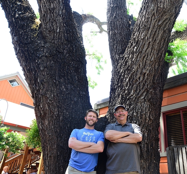
Forest entomologists Jackson Audley (left) and the late Steve Seybold next to a black walnut tree, the victim of thousand cankers disease, in downtown Davis. (Photo by Kathy Keatley Garvey)
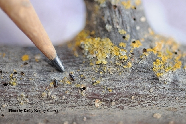
The walnut twig beetle is about the size of a grain of rice. In association with a fungus, it causes thousand cankers disease. (Photo by Kathy Keatley Garvey)
New research clarifies impacts of timber harvest on sediment in watersheds
To effectively reduce these adverse effects of harvest, foresters first need to know the precise causes of sediment increases. Historically, researchers investigating the effects of timber harvest on the land have considered two primary drivers: hydrologic changes following timber harvest or fuel reduction that drive sediment transport, and increased sediment supply from ground disturbances and/or mass movements that result from those harvest or fuel reduction activities.
While these causes are tightly linked, little is understood about the relative role each plays in transporting sediment from the watersheds. In other words, which is dominant in increasing sediment delivery and transport: increased streamflow due to greater water availability that can sweep up and transport sediment, or a greater supply of sediment entering the waterway in the first place?
A new analytical approach developed by Safeeq Khan, UC Cooperative Extension specialist in water and watershed sciences at UC Merced, and collaborators now provides valuable insights into this issue, and ways to target effective mitigation strategies.
Published in the Journal of Hydrology last fall, the team's study analyzed long-term (1952-2017) streamflow and sediment data from two adjacent paired watersheds in the H. J. Andrews Experimental Forest in the western Cascades Range of Oregon. One of the watersheds was harvested and replanted in the 1960s, while the second was not disturbed and used as a control.
“The data is from Oregon, but highly relevant for our work in the Sierra Nevada,” said Khan, lead author of the study. “We have tried to quantify the effect of hydrologic changes and increased sediment supply from logging activities on total sediment yield.”

To isolate the relative contributions of streamflow changes and increased sediment supply on sediment transport, Khan and colleagues developed a statistical reconstruction technique to account for the hydrologic changes following harvest.
“This approach allows us to analyze and estimate background sediment production in the treated watershed during the post-treatment period as if the harvest had not occurred, which is remarkable,” said Khan.
The new approach demonstrated that sharp increases in sediment following harvests can be confidently attributed to ground disturbances associated with timber harvest or thinning operations to reduce fuel. Changes in sediment supply overwhelmingly dominate streamflow in terms of contributions to increased sediment in the watershed. Streamflow increases alone led to modest increases in sediment, less than 10%, with the watershed transporting about twice as much total sediment than it would have had the area been left unharvested. This effect diminishes more or less exponentially over time, especially with respect to suspended sediment, as bare areas revegetate, which reduces hillslope sediment supply, and as streamflow returns to pre-treatment levels.
“Once we know the background sediment production, we can easily attribute how much of the increase is due to what mechanisms” said Gordon Grant, a hydrologist with the U.S. Forest Service Pacific Northwest Research Station and co-author on the study.

“Determining that increased sediment in watersheds after harvests is primarily driven by ground disturbance is crucial in targeting mitigation efforts,” explained Khan. “Now, we know that strategies that limit ground disruption – like suspending logs while transporting instead of dragging them, avoiding heavy machinery when and where possible, and mastication and mulching – are likely to be highly effective in reducing sediment yields.”
These changes are most pronounced in the first few years following harvest, but the treated watershed did not return to pre-harvest levels of sediment for two decades, underscoring the long-term effects of harvest on a forest's hydrologic and geomorphic systems.
While clearcutting is no longer practiced on U.S. federal land, it is still the primary timber harvest method used across the globe. Additionally, many other types of forest disturbances such as wildfires, mass tree die-offs, and salvage logging create hydrogeomorphic conditions not too different from clearcutting.
"Our findings provide insights that can help land managers and foresters better target land management and restoration in the future,” said Khan. “We're hopeful that these results will lead to strategies that minimize the long-term impacts and legacies of intense land-use disturbances.”
The full study, titled “Disentangling effects of forest harvest on long-term hydrologic and sediment dynamics, western Cascades, Oregon" is available online in the Journal of Hydrology at https://www.sciencedirect.com/science/article/pii/S0022169419309941?via%3Dihub.
New mobile app identifies hazardous trees for public safety

"Trees are poems that the earth writes upon the sky,” wrote Kahlil Gibran. But trees falling into power lines have sparked catastrophic fires and falling trees have injured nature lovers.
To prevent power outages, PG&E looks for trees near power lines that need to be trimmed or removed. To prevent power outages and other mishaps caused by failing trees, Matteo Garbelotto, UC Cooperative Extension forest pathology specialist at UC Berkeley, has incorporated science into a mobile application that can be used to determine whether a tree presents a hazard and should be removed.
“PG&E was doing tree surveys with pencil and paper,” said Garbelotto, who saw the manual process as fraught with opportunities for error. A paper record needs to be sent to a central collection site where it is transcribed. In the transcription process, mistakes can be made. And there's no way of verifying if a person actually examined the tree to fill out the form.

“Why don't you do a digital survey?” he asked a PG&E tree surveyor. “Using a tablet or phone, the data could be shipped directly, in real time, to the San Francisco office. Using a phone or GPS device, you will know the precise location of the tree and know the worker did the job. If there's a fire, you have proof.”
PG&E Corporation Foundation, the philanthropic arm of the utility, gave Garbelotto a $70,000 grant to develop the app he envisioned for determining which trees are hazards.
“Developed by dedicated UC Berkeley researchers, the tool will provide benefits for other utilities and the forestry industry as they work to create safe and healthy forests. The easy-to-use mobile platform collects data in real time and creates a record that the survey was completed including relevant details like “when,” “where” and “who,” said Stephanie Isaacson, director of community relations for PG&E.
The UC Cooperative Extension tree disease expert created a list of questions that help evaluate tree health. For example, in addition to asking if the tree leaning toward a power line, surveyors are asked, Are there obvious signs of internal decay? Is there a large wound on the tree?
“If a tree has a wound of 5 inches or more, there is a good chance there is significant decay behind the wound,” Garbelotto said. “If there is a mushroom or conk growing on the tree, that portion of the tree is dead and the branch or whole tree may fall down.”
The app, which Garbelotto has dubbed “Evalutree,” can be used for more than powerline safety.

UC Berkeley Ph.D. student Michael Johnson has been using the app to evaluate different species of trees.
“We have just started our third field season using the app on a project for the Department of Defense that quantifies the health and economic value of the oak woodlands on the 100,000-acre Vandenberg Air Force Base,” said Johnson. “We started with coast live oak the first summer, added tanoak the second summer, and have expanded to bishop pine this summer.”
The mobile app has simplified data collection for Johnson, who is in the Forest Pathology and Mycology Lab at UC Berkeley.
“I used pencil and paper studying postfire aspen regeneration on Forest Service land in Northern Arizona in 2012-2013, where I also did my master's work on ponderosa pine decay in 2013-2015,” Johnson said.
He described his undergraduate work collecting data with pencil and paper carried in a tatum, a 8.5-inch by 12-inch metal case with a clipboard, compared with working with the Evalutree phone app.
“Each day would start with making sure that we had all of our data sheets packed in our bulky field tatums,” Johnson said, “making sure our GPS points were preloaded in a separate, expensive GPS device, making sure that our camera had batteries and that we had dry erase markers for our small white board so that we could indicate which plot each photograph belonged to.
“After the fieldwork was complete, we would spend weeks doing data entry, trying to make out the scrawled numbers and notes – smeared with charcoal and raindrops – and sorting and compiling the data, photos and GPS points. It was time-consuming and painstaking, to say the least.”
For his graduate research, Johnson was able to enter data directly into a spreadsheet on a field computer. “At the end of the field work, I would just have to compile the data from the computer, photos from the camera, and GPS points from the Garmin to make a report,” he said.
“Evalutree has changed all of that. Instead of field tatums and multiple bulky devices, I walk out into the field with a lab cell phone. The app has preloaded survey questions, the ability to connect photographs to specific plots, and drops GPS points at each plot and tree that I survey.”

Working in the U.S. Defense Department's sprawling, undeveloped landscapes, Johnson said, “We are often in the field all day without internet or phone connectivity. The app is prepared to meet this challenge and relies on our phone's internal storage and pre-existing GPS functionality to order and store our data with precision accuracy. At the end of the day – when we have returned to civilization and technology – we simply upload all of our surveys for the day and I immediately have my data and reports in multiple formats, including pdf, xls and kml files, at my fingertips.
“Within minutes, I can update my maps to show the exact location of all of the day's surveys, start crunching data in Excel, or print out a report with the photographs from each plot for my boss,” Johnson said.
Garbelotto, the UC Cooperative Extension specialist, would like to make the technology available to cities and companies that manage trees.
“The app can be used by any agency or government that owns or manages a significant number of trees and needs to run surveys on a regular basis to ensure these trees are not at risk of failing, causing property damage or, worse, casualties or injuries to people,” Garbelotto said.
“The surveys can be easily customized for different projects,” he said. “It can be used for campgrounds or parks to calculate the likelihood of a tree failing and likelihood of causing damage. You could have an answer within minutes of submitting the survey.”
For more information about Evalutree, contact Garbelotto.
This story was updated July 21 to add a quote from PG&E.
Reforestation in a burning climate

Have you given your favorite tree a hug lately? Perhaps you would rather plant a tree? Well, on March 21, International Forest Day, Californians have a good excuse to do both.
In the first two decades of this new century, fire is having a transformative effect on California forests. Fires are burning with larger proportions of high severity and these high-severity patches are much larger, in many cases exponentially larger than would have occurred under natural fire regimes. This creates landscapes where all living trees – and potential seed sources for the next forest – have been killed. While fires can also have restorative effects and many species in California are adapted to fire, some species, like ponderosa pine, aren't adapted to these large, high-severity fire patches which alter the natural regeneration dynamics of the dry Sierran mixed conifer forests.

Across U.S. Forest Service lands in California, an average of 50,000 acres of forestland burned at high severity between the years 2000 and 2015; however, less than 30% of these acres were reforested on an average annual basis during this period. This creates a net cumulative loss of forest cover across public lands in the state.
To compound the complexity of this problem, there are growing instances of these large high-severity patches, burning again at high severity one to two decades later due to the homogeneity of vegetation and fuel profiles in the early seral stages after a fire. In 2013, the Rim Fire burned over 257,000 acres of largely mixed conifer forest, a notable portion of which had been replanted after the 1987 Stanislaus Complex Fire. Now foresters have to think: "Not only do we have to consider reforestation after a fire, but we must consider how we keep these young trees from burning up again!"
A common theme many ecologists agree on is that heterogeneous landscapes may be more resilient to fire – essentially breaking up the continuity of fuels and diversifying forest structure helps moderate fire behavior. However, over the past half century in California, we have tended to replant fires with a somewhat dense uniform square grid-spaced pattern of trees, which grow into a homogeneous carpet of new forest. As these trees grow, these dense plantations require maintenance – also referred to as “timber stand improvement” – activities to reduce competing shrub competition and “thin” the trees in order to maintain tree vigor and growth and reduce the fire hazard within the planted stand. Funding for timber stand improvement can wax and wane with the forest products market or federal budget priorities, and, on U.S. Forest Service lands, many of these plantations did not have follow-up treatment.

Seeing this problem brewing across the state, in 2005, a small sect of curious silviculturists and forest ecologists started asking some poignant question such as “Why do we spend money to plant trees which we will then spend time and money to remove a few years later – why don't we just plant less trees?” and “If heterogeneity is important for resilience, why do we always plant new trees in evenly spaced rows?” To many, this was, and still might be, heresy. But it begs a broader philosophical question that if we have diverse objectives for our forests, is it always appropriate to re-establish them in generally one uniform way? More importantly, given the latest fire trends, how can we promote heterogeneity and resilience to fire when we establish forests through planting?
I was one of these intrigued silviculturists. Linda Smith, culturist on the Plumas National Forest, and I started designing and planting low density, wide-spaced cluster plantations in 2007, after the 2006 Boulder Fire. The fire burned in a recreation area adjacent to a lake and part of our objective was to create a forest that would mimic a more naturally appearing structure, but we also knew this could be congruent with fire management objectives as well.

Ten years after the 2007 Moonlight Fire, much of the public lands were dominated by a homogenous fuel profile of flashy grasses, standing dead trees, a jack-strawed arrangement of fallen dead logs, and chest-high shrubs. While some of these stands had been planted, no site preparation or management of competing vegetation had been funded. We knew that any trees in this intermix would have a long haul competing against the shrubs, and in the meantime were exposed to high fuel-hazard each fire season.
Knowing something had to be done, the Plumas National Forest developed partnership agreements with the Sierra Nevada Conservancy and the Feather River Resource Conservation District to prepare the site, reforest and manage competing vegetation over approximately 3,000 acres. They also developed partnership agreements with Brandon Collins, a research scientist with both the U.S. Forest Service's Pacific Southwest Research Station and UC Berkeley Fire Science Laboratory, and Malcolm North, UC Davis associate professor of forest ecology, to monitor the success of different reforestation techniques at promoting heterogeneity and resilience to fire.
Through this partnership, we set up a replicated study to examine the effects of site preparation, planting, and competing vegetation treatments at promoting tree establishment and heterogeneity in young plantations.

This spring will be the one year mark for the planted seedlings! There's still a bit longer to go before we're ready to reintroduce fire to the plantations, but we're on our way to that end goal.
In a sense, wildfire may have beat us out: Some of the wide-spaced cluster plantations that Linda and I planted in 2008 after the 2007 Antelope Fire burned 11 years later in the 2019 Walker Fire. I am pleased to see tree survival and some variable mortality. Looks like there will be some trees that deserve a hug this spring!
